- 11-02-a032711_1
- Item
- [ca. 1889 - 1891]
Part of Robert Reford fonds
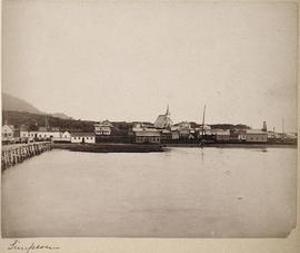
Item is an image of a coastal village. According to annotations, photograph was taken in Lax-Kw'alaams (previously known as Port Simpson and Fort Simpson).
575 results directly related Exclude narrower terms
Part of Robert Reford fonds
Item is an image of a coastal village. According to annotations, photograph was taken in Lax-Kw'alaams (previously known as Port Simpson and Fort Simpson).
Part of Anthony Carter fonds
Image of Lava Lake, headwaters of lake of a Nass tributary. A similar image is printed on page 131 of Carter's book Abundant Rivers.
Anthony Carter
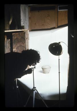
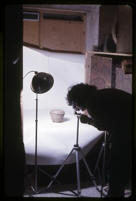
Laura Greenberg photographing baskets
Part of MOA General Media collection
Laura Greenberg photographing baskets from the Museum of Anthropology in the museum's old location in the library basement.
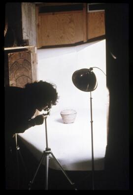
Laura Greenberg photographing baskets
Part of MOA General Media collection
Laura Greenberg photographing baskets from the Museum of Anthropology in the museum's old location in the library basement.
Laura Greenberg photographing baskets
Part of MOA General Media collection
Laura Greenberg photographing baskets. This photograph was taken in the Museum of Anthropology's old location in the library basement.
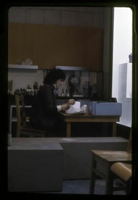
Part of MOA General Media collection
Laura Greenberg working in the Museum of Anthropology's old location in the library basement.
![Last pole at Aiyansh on Nass [River]](/uploads/r/null/c/2/6/c26d321a94edb21da227658edfed797d7338f69954bdd4601b027aad7679131a/a035208c_142.jpg)
Last pole at Aiyansh on Nass [River]
Part of Harry B. Hawthorn fonds
Pole is largely uncarved, except for a bird perched on top. Mountains are visible in the background.
Lame Charlie - Bella Coola - BC, 1922
Part of Harlan Smith collection
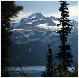
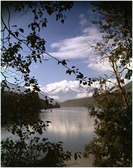
Lake Garibaldi and Mount Garibaldi
Part of Anthony Carter fonds
Image of a mountain side with a glacier(s) and a lake in the foreground, possibly Lake Garibaldi and Mount Garibaldi in southern British Columbia.
Anthony Carter
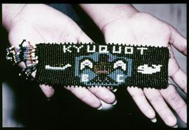
A close-up image of person's hands holding a Kyuquot beaded wrist band. According to the documentation included with the filmstrip, the description of the image states "Natalie Vincent holds a beaded wrist band. Can you see three traditional Nootka patterns: the Whale hunter in his canoe, the whale, and the eagle?"
Kyuquot: Village by the Sea collection
In 1976, a group of students from the Kyuquot Elementary, a First Nations elementary school on the West coast of Vancouver Island, decided to make a filmstrip that documented their lives in the fishing village. The children’s intention behind making these photographs was to raise money for a summer field trip to Victoria, Vancouver, and the Okanagan. As part of the fundraiser, the children made a visual map depicting their daily travel to school by boat and a hand-written order form for the film. Collection consists of documents created by the Kyuquot Elementary School and Mr. Moore, a former Assistant Professor of Anthropology in the 1970s. The collection consists of one correspondence letter written by Mr. Moore requesting a copy of their filmstrip, four pages of typewritten filmstrip descriptions, one handwritten map and flyer created by the Kyuquot Elementary School and one 70 frame color filmstrip that was digitized in 2017. [At the time of processing, it was unknown if the fundraiser was successful.]
Kyuquot Elementary Secondary School
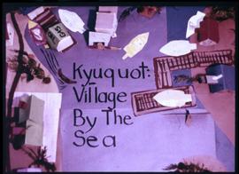
Image of a model constructed by the Kyuquot Elementary School children titled "Kyuquot: Village by the Sea."
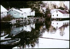
An image showing various houses near the water with people in the distance, the house on the right is built on wooden beams. According to the documentation included with the filmstrip, the description of the image states "The white building on pilings is the store and Post Office. Can you see the last dugout canoe made in Kyuquot?"
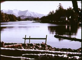
An image showing the Kyuquot Sound from the beach shore with houses and mountains in the background. According to the documentation included with the filmstrip, the description of the image states "Looking out toward Kyuquot Sound."
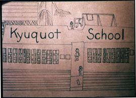
Image of a drawing by the Kyuquot Elementary School children titled "Kyuquot School".
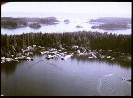
An image of an aerial view of the Kyuquot village. According to the documentation included with the filmstrip, the description of the image states "Kyuquot from the air. You can see Walter's Island and out into the Pacific Ocean. The next Island to the right is Aktis Island, the ancestral home of the Kyuquot Band. In the early 1800's the Kyuquot Band was the largest on the West Coast of Vancouver Island. However one night in 1855 the Clayoquots, enemies to the Kyoquots, surprised the Kyuquot Village on Atkis Isl., cut off the heads of the Kyuquot warriers, took the women as slaves, and set fire to the village. Most of the village was destroyed during this, the last tribal war fought on the West Coast of Vancouver Island. A few years ago most of the Kyuquot Band left Atkis Island and moved into Walter's Cove."
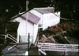
An image showing two buildings with a small shed, a dock and a flag pole at the front. According to the documentation included with the filmstrip, the description of the image states "The far building is the Primary classroom (K-3), while Intermediate grades (4-7) are held in the other building. Can you see the school wharf? You would have to come to school in a boat if you lived in Kyuquot!"
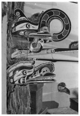
Kwakwaka'wakw mask display at U.B.C. Museum of Anthropology
Part of Anthony Carter fonds
Image of Kwakwaka'wakw masks display at the Museum of Anthropology at the University of British Columbia.
Anthony Carter
Kwakwaka'wakw mask display at U.B.C. Museum of Anthropology
Part of Anthony Carter fonds
Image of Kwakwaka'wakw masks display at the Museum of Anthropology at the University of British Columbia.
Anthony Carter
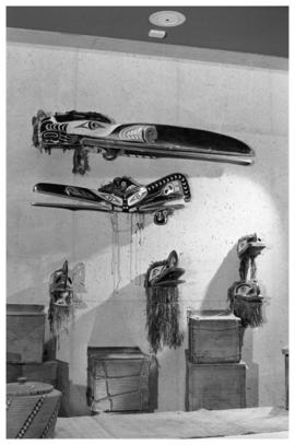
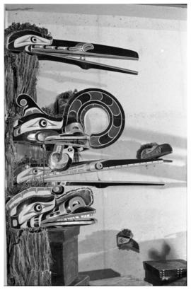
Kwakwaka'wakw mask display at U.B.C. Museum of Anthropology
Part of Anthony Carter fonds
Image of Kwakwaka'wakw masks and material culture display at the Museum of Anthropology at the University of British Columbia.
Anthony Carter