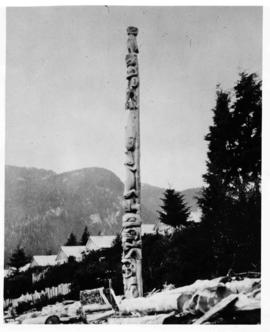
Native Youth Programme study trip to Alert Bay, Campbell River, and Port Angeles (40 min)
- 110-3-F-Video 201
- File
- 26-31 Jul. 1993
575 results directly related Exclude narrower terms
Native Youth Programme study trip to Alert Bay, Campbell River, and Port Angeles (40 min)
Nautical chart of Walters Island
An image showing a sea map of Walters Island, a small blue circle at the top center indicates the approximate location of the Kyuquot village. According to the documentation included with the filmstrip, the description of the image states "Kyuquot as shown on chart (A chart is a sea-map used by fishermen and boaters.) Compare the chart and the map."
Part of Harry B. Hawthorn fonds
Image of Douglas Lake, in the Nicola Valley region of British Columbia.
Part of Anthony Carter fonds
Image of water stains on the walls at the Museum of Anthropology at the University of British Columbia.
Anthony Carter
Part of Anthony Carter fonds
Image of water stains on the walls at the Museum of Anthropology at the University of British Columbia.
Anthony Carter
Part of Anthony Carter fonds
Image of water stains on the walls at the Museum of Anthropology at the University of British Columbia.
Anthony Carter
Part of Anthony Carter fonds
Image of water stains on the walls at the Museum of Anthropology at the University of British Columbia.
Anthony Carter
Part of Anthony Carter fonds
Image of water stains on the walls at the Museum of Anthropology at the University of British Columbia.
Anthony Carter
Part of Anthony Carter fonds
Image of water stains on the walls at the Museum of Anthropology at the University of British Columbia.
Anthony Carter
Part of Anthony Carter fonds
File consists of images of water stains on the walls and floor of the Museum of Anthropology at UBC.
Anthony Carter
Part of Anthony Carter fonds
Image of water stains on the walls at the Museum of Anthropology at the University of British Columbia.
Anthony Carter
Part of Anthony Carter fonds
Image of water stains on the walls at the Museum of Anthropology at the University of British Columbia.
Anthony Carter
Part of Anthony Carter fonds
Image of water stains on the walls at the Museum of Anthropology at the University of British Columbia.
Anthony Carter
New pole in Old Massett, Robt. Davidson, Massett, Aug. 69
Part of Harry B. Hawthorn fonds
Image of a totem pole in Massett, Haida Gwaii. The pole was carved by Robert Davidson, and is seen just after it was raised. A crowd is still gathered for the pole raising ceremony.
Part of Harry B. Hawthorn fonds
Image of fields, hills and dirt road in the Nicola Valley region of BC.
Part of Harry B. Hawthorn fonds