Zone du titre et de la mention de responsabilité
Titre propre
Maps
Dénomination générale des documents
- Cartographic material
Titre parallèle
Compléments du titre
Mentions de responsabilité du titre
Notes du titre
Niveau de description
Série organique
Cote
Mention d'édition
Mentions de responsabilité relatives à l'édition
Mention d'échelle (cartographique)
Mention de projection (cartographique)
Mention des coordonnées (cartographiques)
Mention d'échelle (architecturale)
Juridiction responsable et dénomination (philatélique)
Zone des dates de production
Date(s)
-
1955 - 1976 (Production)
Zone de description matérielle
Description matérielle
70 maps
Zone de la collection
Titre propre de la collection
Titres parallèles de la collection
Compléments du titre de la collection
Mention de responsabilité relative à la collection
Numérotation à l'intérieur de la collection
Note sur la collection
Zone de la description archivistique
Nom du producteur
Historique de la conservation
Portée et contenu
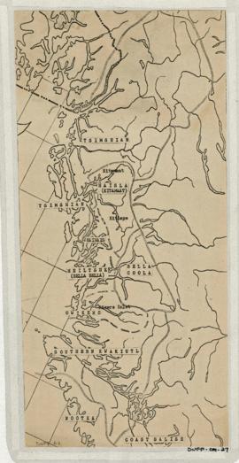
Maps created, acquired, and used by Duff in his research and teaching activities. The materials show geographical features; location and boundaries of territories and villages of Northwest coast native people; reserves; language families and distribution, influences, and historical features. Included are ms. maps; and copied, traced, outline and published maps, most with added ms. notations.
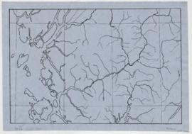
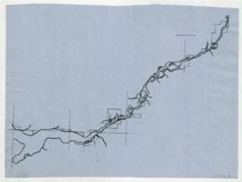
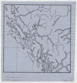
The Base maps sub-series consists of topographic maps produced as bases for the creation of other maps to show the locations and territorial boundaries of native people within British Columbia. Maps include ms. notations by Duff.
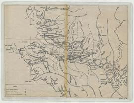
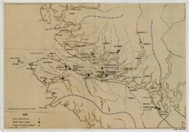
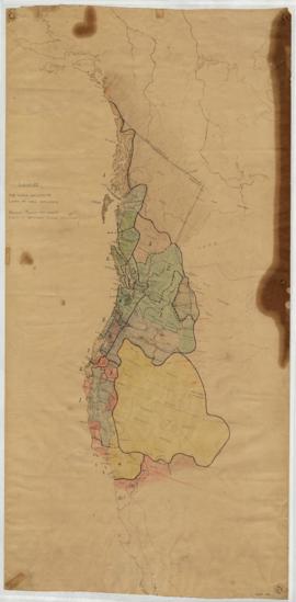
The Territory maps sub-series consists of ms. maps; and base, outline, copied and photocopied maps with ms. notations. Items show location and boundaries of native territories in British Columbia and the United States. Includes maps showing extent and detail of Tsimshian territory; Kispiox sites; Kitwancool territory and sites; South Kwakiutl territory, villages and tribes. Notations identify some place names and villages.
The Reserve maps sub-series consist of copied and published maps with ms. notations showing the location and extent of various reserves. Some acreage is also included.
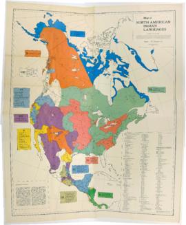
The Miscellaneous Maps sub-series consists of published, copied and outline maps showing language families in North America, influences on British Columbia native people, historical distribution of native people in B.C., and Vancouver Island in the 19th century.
Zone des notes
État de conservation
70 maps: ink, pencil, applique and brown-line on paper, tracing paper and linen, most col. ; 17x17-137x 170 cm.
Source immédiate d'acquisition
Classement
No discernible original order existed at the time of processing, therefore, the materials have been arranged into sub-series based on their apparent use. While the creation of a few of the maps and some of the notations can be attributed to Duff, the responsibility for many ms. maps and ms. additions is unknown. The date of creation of most of the published maps acquired by Duff can be clearly identified, however, it is uncertain when these might actually have been used, or when the ms. notations might have been added. Accordingly, published maps with ms. notations have been recorded showing a span of dates, from the publication date to 1976.
Ms. notations on many maps follow a system of circular symbols used by Duff to indicate former villages, present villages, and non-Indian settlements. A legend for these markings can be found on Duff-CM-40 and Duff-CM-39. The materials were initially identified, in pencil, by “Duff” followed by an item number. Wherever possible, this earlier marking has been removed, but it remains on encapsulated items. To avoid confusion, maps processed during the creation of this finding aid have been labelled in pencil or black marker with “Duff-CM-” (for cartographic material), followed by an item number.
Langue des documents
Écriture des documents
Localisation des originaux
Disponibilité d'autres formats
A portion of this series has been digitized.