Trickster Performance Hand-Out 1988
- 110-1-A-9
- File
- 1988
13481 results with digital objects Show results with digital objects
Trickster Performance Hand-Out 1988
[Trickster - "A Rattling Under Glass"] [restricted]
Part of Director's fonds
Tribute to the Dead, 1912, Piegan, Montana
Part of Roland Reed collection
Image of a Piegan Blackfeet memorial structure, with a man and woman next to it.
Part of Wilson Duff fonds
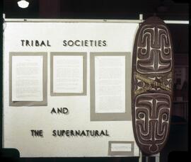
Tribal societies and the supernatural
Part of MOA General Media collection
Introductory panel to the exhibit "Tribal Control of the Supernatural."

Tribal societies and the supernatural
Part of MOA General Media collection
Introductory panel to the exhibit "Tribal Control of the Supernatural" at the Museum of Anthropology, in its original location.
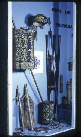
Part of MOA General Media collection
Display for the Museum of Anthropology. Uncertain relation to exhibitions. Shows spears, clothes, hats, baskets, and other items from Indonesia.
Part of Wilson Duff fonds
Item is a copied base map with ms. additions showing Tlingit, Haida, Pentlatch and Bella Coola territories in eighteenth-century British Columbia. Notations in Duff's hand. Encapsulated. Base map: British Columbia base map, Duff-CM-23.
Part of Director's fonds
Part of Eric Parker fonds
Item is a negative showing trees, mountains and the sky.
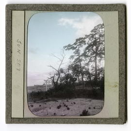
Trees and tori gate on hillside
Part of James Davidson collection
Item is a photograph of trees and a tori gate on a hillside. Reads, "SUN SET."
Part of James Davidson collection
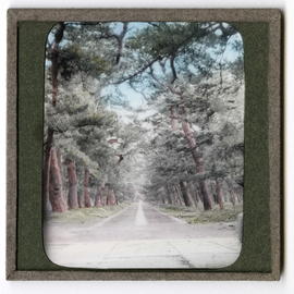
Item is a photograph of a tree-lined road.
![Treeline[?] of Nathula](/uploads/r/null/8/2/82520f7de1da29fe84e004d7ae8a2752f214f36b0bcdb3b98b59b5c213deceac/a033562c_142.jpg)
Part of Eric Parker fonds
Item is a photograph showing a house situated in a forest.
Part of James Davidson collection
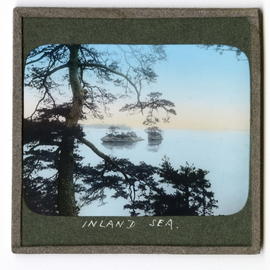
Item is a photograph of a tree in the foreground with sea and islands in background. Reads, "INLAND SEA."
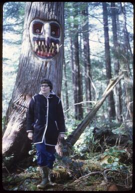
Photograph of an unidentified woman standing in the forest in front of a tree that has a face carved into it and painted. The tree is likely in or near Alert Bay, BC.
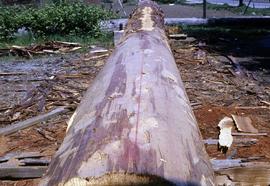
Tree with bark partially removed
Part of Virginia Kehoe fonds
Image depicts a tree with the bark partially stripped.
![Tree trunks [Upper Mimika, New Guinea]](/uploads/r/null/f/b/4/fb467ba526a377ae66e9b30a434fc8dae7aec1fc60e167d9550b49264057162c/a032998c_142.jpg)
Tree trunks [Upper Mimika, New Guinea]
Part of A.F.R. Wollaston fonds
A.F.R. Wollaston
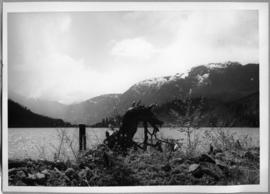
Part of Stanley E. Read fonds
Image depicts an object that may be a bent tree trunk at the edge of a body of water. The foreground contains brush; mountains are visible in the distance.
![[Tree stumps with carvings and tools]](/uploads/r/null/5/0/7/507f43cd027d3c33892d91d185e4d887fdab9b28fa4bac0ee00c8a56cded688e/a036047c_142.jpg)
[Tree stumps with carvings and tools]
Part of Ronnie Tessler fonds
Image is of two tree stumps upon which two carvings are placed. Wood scraps, tape measure(?) and chisels are placed on top of one stump. Hand-adzes and chisels are visible in background of image.